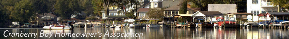
THE HISTORY OF CRANBERRY BAY
THE BOUNDS FAMILY, THE BOUNDS ADDITION AND MAPLE BAY
![]()
Buckeye Lake is a canal land lake (Feeder Lake) built to provide water for the Ohio Erie Canal. Originally a swamp, it was hand dug and flooded to form Licking Reservoir. Later, the name was changed to Buckeye Lake. The first visitors to this area were the Hopewell and Adena Indians who camped along the shores of Buffalo Swamp as they journeyed to and from the many mounds located throughout Licking County.

Union Township and Licking Township were settled by farmers, some were from the Ohio Company, a wealthy group of Virginians that settled and received land in the Ohio Territory. By 1875 the largest farms in the Buckeye Lake area were the John H. Myers Walnut Hill Farm, the Bounds Reservoir Farm, and J. Neel’s Locust Cottage. During these agricultural years the Reservoir served as a prime hunting and fishing area and as a picnic site for visitors. In winter the Reservoir provided ice which was cut and stored in ice houses for use as the main cooling agent during the summer months. Finding gas wells on these farms and the development of pipelines throughout this area made life easier on the farms.
The original Bounds Farm and land encompassed an area bordered by Maple Bay on the east; Buckeye Lake on the south; what is now known as SR 79, as well as East Street on the west; to SR40 on the north: an area well over 1100 acres. The assemblage of lakefront land by the Bounds Family was concluded by Jackson and Robert Bounds in 1852 when they purchased respectively 167 acres (now in part Bounds Addition) from William Boggs and in 1853 when they purchased 39.5 acres (now Maple Bay) from Harrison Hupp. Their father, William Bounds, had amassed the land north to SR40 eastward to Lakewood High School (where a Bounds’ father, Thomas, an immigrant from England, had sizeable land holdings and farms that he deeded to William and was subsequently sold in 1817 to Lawrence Washington (yes, George’s brother). William’s wife, Miriam, continued to drive cattle to Virginia from the Bounds Farm after his disappearance in 1843 when it was suspected he was killed for the large amount of gold he used to carry.

The Bounds Farm
Linsley H. and Julia Bounds, Charles and Mary Bounds and Eliza Bounds (widow of Jackson) sold 65.09 acres for $10,000 March 18, 1903 to the Columbus, Buckeye Lake and Newark Traction Company who built the electric powered trolley line (also known as the Inter-Urban Line) which connected the three communities. The Traction Company and Southern Ohio Public Services Company built the Buckeye Lake Amusement Park in conjunction with John Carlin, Sr. and sold it to him July 10, 1929. John Carlin, Sr. had built an amusement park in Baltimore, Maryland and was asked to come here and build an amusement park. The northern boundary of the 65 acres of Lake Frontage referred to above was what is now known as Union Street. Jackson Bounds sold land to John Holtsberry in 1868 south of Park Avenue facing SR79 for the Holtsberry Addition (area where Bangkok City, Mama Jules Rib Shack and residences to the east along the State Boat Ramp now exist).
As the Interurban began to bring crowds of people to the Park, The Bounds family started leasing lots in 1904 at the south end of East Street. The first three dwellings were the Beaumont, Nelson and Irene Werkhavens, (originally owned and built by Ms. Mary Harrison, Postmistress of Reynoldsburg), and Sarah Pettit (at the south end of First Street(Anchors Way). Sarah Pettit also owned two additional cottages which she rented on a weekly basis in the summer. The Werkhavens paid $1,200 on August 3, 1928 and $35 per year lot rent. In the early years The Beaumont was owned by fourteen single men from Columbus who used it as a fishing lodge. The group was headed by George Fetters and Tom Kirk who had an auto body shop in Columbus. The waterfront area near The Beaumont (French for beautiful) was known as Beaumont Beach where as many as 200 Bounds and area residents enjoyed the sandy beach until the 1950’s. In the 1940’s and 1950’s the Community Church held their baptisms there.
Several of the dwellings in the Bounds First Addition were built in the nineteen tens and teens by Mr. Ed Huber who was one of the fourteen men who owned the Beaumont. With the lack of decent roads, most material was brought in on a barge. The main road to the area was from Kraner’s Corners on SR40 (which went through the middle of the original Bounds Farm). This road today is Mill Dam Road. The area was served by electric from a power plant in Hebron as well as natural gas (a well existed at the end of Sixth Street(Misty Lane) and on the Bounds Farm there were two additional wells. In the twenties and thirties the 37-volt electric power created a great deal of blinking in the lights and numerous homes had gas lights as well. Throughout the area there were community water wells and only a few private water wells. One inactive community well head exists at the southeast corner of Bounds (Cranberry Lane) and Third (Nautica Way). Another community water well is located on the southwest corner of Anchors Way and Dockside. The well on Slocum is located on the alley (Waterfront Strip) on the western side of the home at the corner of Marsh Lane and Slocum. The community well in Maple Bay is operable and located on private property at the northwest corner of Bay Street and Maple Avenue.
During the Post-World War I years through the late thirties the surge of activity at the Amusement Park created a demand for housing. The Park, swimming, fishing, and hunting all created a strong demand for weekly rentals of cottages. The Braig family owned 21 such cottages and rented them for $30 to $40 per week. The Fred Braig family rented boats, fishing tackle and bait for many years across from Cranberry Marsh. Subsequently, Bounds Addition extended eastward creating the Bounds 2nd, 3rd, 4th, 5th additions. Most of the cottages had names to distinguish one from another. Park Street ran from the Buckeye Lake Amusement Park directly into the Bounds First Addition. Many of the weekly rentals were families here to enjoy Buckeye Lake, the Playground of Ohio. They took in the rides, games, foods, and the Entertainment that featured National Big Bands. The tornadoes of June 11, 1922 and June 19, 1928 spared the Bounds community but hit the area near the Buckeye Lake Yacht Club very hard. The west portion of Cranberry Bog was hit slightly by the 1928 storm. Cranberry Bog used to extend 700 feet westward and was closer to the mainland where the channel now exists.

Harry Falk – A Days Catch – circa 1945
Businesses to accommodate the vacationers sprang up in the Bounds Addition. There were two boat liveries near the end of First Street (Anchors Way & current Lakeview): one business was owned by Abe George, also known as “One Arm George” because he lost an arm in a boating accident. The other livery was owned by Bill Kitzmier. Kitzmier moved his operation, two story house and all, eastward to what was known as Cranberry Wharf (now the gated area owned by Mallory Square). There he rented boats for 50 cents a day with fishing poles free! Kaiser Grocery Store was located on the southeast corner of Union and First Streets (Anchors Way). During the 40’s and the 50’s numerous house-to-house deliveries and services were available such as bread, milk, honey and a grocery boat made stops on a regular schedule.

Beaumont Beach 1951 or 1952

Beaumont Beach 1951 or 1952

Buckeye Lake 1953 – 923 Maple Ave.
Another factor that contributed to the development of life at the Lake was the fact that although there were a number of residences in what is currently known as the Village of Buckeye Lake, all except the farms, were on leased land. The land owners of the additions that were developed to provide summer cottages for the Buckeye Lake Park (Bounds, Myer, Neel, Rosebraugh, Elliott, and Carlin) were the “law” before the Village was incorporated in 1980. If someone made too much noise, had too much to drink too often, had too many guests, the neighbors called the landowner (Margaret Bounds in the Bounds Addition). Margaret took care of the problem. She ruled with an “iron hand”. If the problem persisted, the Bounds canceled your lease. These families were not subject to the laws that exist today for apartment dwellers because leased lands were not considered rentals. The Village police have taken care of law enforcement since the incorporation of the Village of Buckeye Lake. The Licking County Sheriff patrols the Maple Bay area. The Village was not incorporated until 1980 because there were not enough free land holders until the State of Ohio sold the leased land on North Bank and the Neel and Myer families sold the leased land in their additions. Although it was still a cottage area, people began to consider year round residences once they became landowners.
As in all communities, the availability and improvement of utilities brings growth. Since the sanitary system was installed in 1955, year-round residents have steadily increased. The Community water wells began to disappear as people had their private wells drilled in the late fifties. When Cranberry Pointe bought out Cranberry Wharf and the Blue Goose, they installed a public water system hooking into Licking County Water and Waste Management. After completing the first condominium building Maple Bay received water in 2002. In 2009 the Village of Buckeye Lake received federal funds to run water lines throughout the Village including Cranberry Bay. The hookup is scheduled for spring, 2010.
During the 60’s and 70’s more families began to purchase the cottages on the Bounds leased land. The leases were originally for 25 years. During the 80’s the leases were shortened to 10 years and during the 90’s as the Bounds Family prepared to sell the farm, the leases became 5 years with 5 years renewable. Margaret Bounds administered the Bounds Additions from the late 40’s until 1990. John J. Bounds, Margaret’s brother, acted as the family administrator from 1991 until his death in 2005. John employed Management Companies to invoice and oversee the area until all lots and the Bounds farm were sold.
In October, 1995 residents received notice from the Bounds Family that the lots would be for sale with purchases beginning in January, 1996. At that time the Bounds Family also announced that the Waterfront Strip would be given to the homeowners association so that all cottages with docks could continue to have access to those docks without interference from private owners. Within 3 years 80% of the lots with cottages were purchased by the cottage owners. The purchasing of the lots ushered in a time of renewal where many cottages were replaced with new homes or received significant renovation.
The Homeowners Association was formed in 1989 by a group of neighbors under the leadership of its first president, Larry Edger. Its purpose was to represent the interests of the homeowners and lessees in working with the management and owners of the Bounds Addition in order to continue the quality of home ownership in the area and to have a political impact on the local governments. The Homeowners Association also provided picnics and block parties to build community spirit and to keep the homeowners informed about the relationship with the Bounds Family and the local governments. Persons serving as President include: 1989 Larry Edger; 1990 Adam High; 1991 Emmett Barrett; 1992 Bill Rushay; 1993 J.C.Arter; 1994 Faye Lemmon; 1995-1997 Charlotte Basnett; 1998 Lou Vacca; 1999 Mike Cassidy; 2000-01 Hooch Haynes; 2002-05 Karen Cookston; 2006 Hooch Haynes/Rae LeCompte; 2007-2010 Rickie Sue Grunden.
When the Bounds family announced that they were going to sell off the lots to the cottage owners, they advised the Bounds Homeowners Association to incorporate so that the Association could receive the Waterfront Strip and the Sign Lot. In November, 1995 The Bounds Homeowners Association was incorporated as a private nonprofit organization in the State of Ohio. During the next year The Association worked to get the Bounds family to standardize the price of lots and helped the Bounds family get the streets accepted into the Village as public streets. In the next year the Association changed its name to Cranberry Bay Homeowners Association and the area in the Village of Buckeye Lake is now known as Cranberry Bay and the Maple Bay Addition in Licking Township retained the name of Maple Bay. At the request of the Village, the Association changed the names of all of the streets in the subdivision to reduce the duplication of streets identified by numbers, completing the process in 2001. First Street is Anchors Way; Lake Street is Lakeview Dr E; Second Street is Island View Drive; Third Street is Nautica Way; Fourth St is Lighthouse Lane; Fifth Street is Beacon Light Lane; Sixth Street is Misty Lane; Seventh Street is Lake Mist Drive; Ninth Street is Bay View Drive; Tenth Street is Marsh Lane; Highland Street is Dockside Drive; and Bounds Street is Cranberry Lane; Slocum remained Slocum.
In December, 2006 the Bounds Family completed the sale of the Bounds Farm. In February, 2007 the Waterfront Strip was conveyed to the Cranberry Homeowners Association. In April, 2007 the Bounds Family assigned the management of the Protective Covenants and Easement documents to the CBHA, Inc. The Ohio Department of Natural Resources recognizes the Cranberry Bay Homeowners Association as the owner of the Waterfront Strip which has multiple docks. As such, CBHA, Inc. pays full price for the first dock and pays a reduced fee for all of the remaining docks. The ODNR works directly with CBHA, Inc. in the building of docks, replacement of seawalls, transfer of docks, and in all other matters. Because the lot owners do not own the Waterfront Strip, all transactions go through the CBHA, Inc.
Many lot owners ask why the Waterfront Strip varies in width. In the 1970’s the ODNR and many of the land owners along the Canal Land Lakes were involved in a law suit regarding where the boundaries of the properties were when the area(s) was flooded and a lake built. The Courts ruled that the Rowe Line would be the survey used to determine where the lake high water line could extend onto the Buckeye Lake owners property. The Rowe Line delineates where the lot owner properties end and the Waterfront Strip begins. The area between the Rowe Line and the edge of the water is the area that could be flooded without any liability to the ODNR. In the Bounds area, the family retained that area as the Waterfront Strip. The agreement that the Bounds signed with the ODNR in 1982 is the Lake Lands Agreement that determined that the land owner could not fill in the lake to add more property and that the land owner would protect the current shoreline. It also gave the owner of the land along the lake the authority to determine who had docks on that property and to charge a fee determined by the land owner for the use of the dock. The assigns (CBHA, Inc.) now manage the Waterfront Strip, and have a Dock Use and Indemnification License Agreement (DUILA) with the lot owners so that the docks can be transferred upon the conveyance of the lot or at death as long as the lot owner is not delinquent or has not broken the terms of the DUILA.
Each year the Cranberry Bay Homeowners Association continues to grow in membership and the Cranberry Bay and Maple Bay area continues to be one of the most sought after home sites on Buckeye Lake. Many of the summer cottages have become dream homes that offer the excitement and ambiance of a Lake Community with a rich history.
![]()
2002 – The foregoing was compiled with the help of Helen T. Langel, John J. Bounds, Irma and Nelson Werkhaven, Nora and Lloyd Ballenger, Sue and Dave Sutton, and reviewed by Margaret Bounds.
2009 – Edited and expanded by Rickie Sue Grunden, Ph.D and Linda Roush. It was reviewed by Donna Braig and Charlotte Basnett. A special thanks is due the Buckeye Lake Museum staff and the Licking County Recorder’s Office for making antique maps, original documents, and pictures available. A special thanks to all of the residents of Cranberry Bay who took the time to review old photographs and retell some of their recollections of life in Cranberry Bay and Maple Bay back in the day. It is a story that will continue to grow as we and future generations enjoy life at Buckeye Lake.
~~~~~~~~~~~~~~~~~~~~~~~~~~~~~~~~~~~~~~~~~~~~~~~~~~~~~~~~~~~~
- Bibliography: My Buckeye Lake Story by Donna Fisher Braig, New Concord Press, 1997.
- Directory and Guide of Buckeye Lake, B.B.and D.. of Millersport, 1932.
- Licking County Ohio Atlas, A Combined Reprint of 1847 and 1854 Wall Maps and 1866 and 1875 Atlases, 1992.
- An Autobiography of Dillon S. Myer by Dillon S. Myer. The Regional Oral History Office,The Bancroft Library, University of California at Berkeley, 1970.
![]()